Maps & Favorites
Overview
Reference material for Maps & Favorites in WinTAK, sourced from the official WinTAK 5.7 Software User Manual (26 March 2026).
Manual Reference
The Maps & Favorites Tool allows the ability to view and download supported map and imagery data that has been loaded into WinTAK.

Choose from any of the categories available: IMAGERY, MOBILE and FAVS. Select the IMAGERY tab to view imported imagery files. Select the MOBILE tab to view or download map layers of a desired area. Select the FAVS tab to access frequently used and saved map views.
Saving a Map Layer
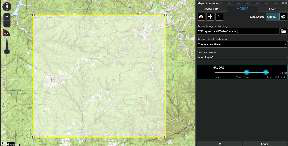
To save a local (offline) copy of a section of an online map, select the MOBILE tab and verify that Map Source is toggled to Online. Choose the desired map source from the list and select the Download button in the top-left corner. A drop-down will appear presenting three options for map area selection: Rectangle, Polygon or Existing Shape. The Rectangle option uses the top left and lower right corners to denote the area to be downloaded.
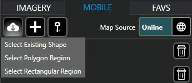
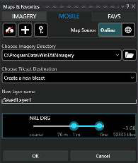
The Free Form option creates a custom area to be downloaded by selecting different points on the map until the shape is complete, or the end button is selected. Existing Shape allows for an already existing shape to be chosen as the area intended to be downloaded. Drag the map source slider end points to select the resolution for the tileset. The number of tiles to be downloaded will be indicated.
A new tileset can be created or the tileset can be added to an existing one. Enter the name to be applied to the chosen layers and select OK. A status indicator will appear to show the download progress. Cancel a download-in-progress by clicking the Red X at the bottom right. Multiple tilesets from different map sources can be downloaded simultaneously. To download additional tilesets once the initial download has started, select the desired map source, select the Download button and repeat the process used for the first downloaded tileset. Each tileset's download progress will be listed at the bottom of the Maps & Favorites panel.
Adding Online Map Sources
WinTAK supports WFS and WMS data sources. From within the Mobile tab, select the +, enter a URL, and select OK to add an online source (WFS/WMS).
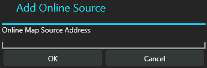
After a valid URL has been entered, choose which WFS/WMS layers to import. WFS/WMS layers can be filtered by using the filter field at the top of the selection window. Imported WMS layers are located under the Maps & Favorites Mobile tab, while WFS layers are located under the WFS category in Overlay Manager.
When Map Source is toggled to Local from the MOBILE tab, a listing of the downloaded imagery layers within the current map view appears. Selecting Show All will display all downloaded imagery layers.
Selecting Outline will toggle the outline layer for imagery on/off. Selecting a layer from the list will display the corresponding map source data on the map.
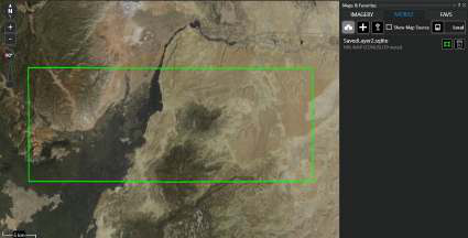
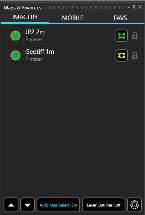
Specific imagery type files can be added directly into the \ProgramData\WinTAK\Imagery folder, imported into WinTAK via Import Manager (drag and drop), or by mapping to an imagery directory in the Directory Preferences. These files can be found under the IMAGERY tab.
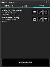
To save the current view, select the FAVS tab and Add Current View. Enter a name for the view and select OK. Select the SEND icon to send the saved view to a Contact, select the Edit icon to edit a favorite's name and select the Delete icon to delete the view from the list. Select a saved view to pan the map to its location.
Creating a Multi-Layer Source
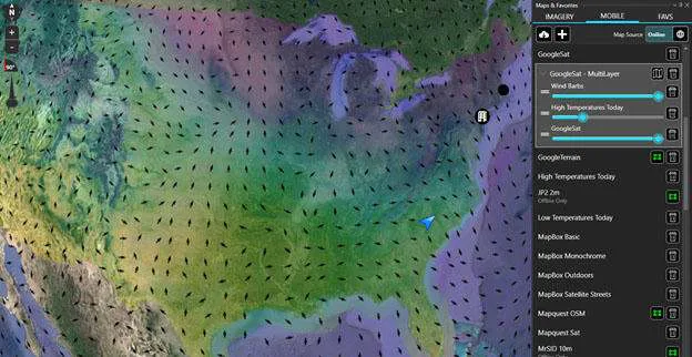
Multiple imported online map sources can be combined into one layer by right clicking an individual source within the Mobile tab and selecting Create Multi-Layer. After the new multi-layer map source entry has appeared, select the Add Layer icon to choose other imported map sources to combine into the same map layer.
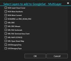
The transparency of each map source within the multi-layer can be adjusted by using the slider that appears beside them. Individual map sources within the multi-layer, and the multi-layer itself, can be deleted by selecting the Delete icon.
Managing Stored Credentials
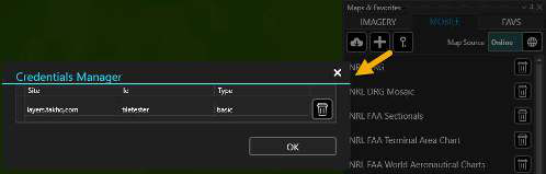
Select Manage Stored Credentials (key) to access and delete cached credentials that were used to download tilesets from imported imagery sources.
Source
WinTAK Software User Manual, Version 5.7, 26 March 2026, pages 35–37.